how was geography important in THE MUGHAL EMPIRE'S development?
 http://upload.wikimedia.org/wikipedia/commons/7/7a/India_Geographic_Map.jpg
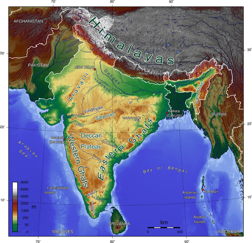
The geography of the Mughal Empire was very important to its development as an empire. The Mughal Empire was located in modern day Northern, central, and western India as well as west into modern day Pakistan and Afghanistan, or more generally, the Indian Subcontinent. The majority of central India, the largest part of the Mughal Empire, is the Deccan Plateau, a fertile land full of great rivers and their river valleys. There is good agriculture in these areas and can produce much food. As well as agriculture for food, other important trade items that were grown or produced in The Mughal Empire's land were cotton, spices, and tea. Most of these products were traded via maritime trade, through the oceans to the southeast and southwest. As well as trade routes, these oceans provided a natural barrier on the southern end of India. Other natural barriers include the Himalaya Mountain Range to the North/northeast and the Hindu Kush to the northwest. The land of the Mughal Empire was abundant in highly demanded trading products and the bordering oceans were very convenient for trade, therefore helping the Mughal Empire to flourish. As well, the Mughal Empire's land had very good natural boundaries to help repel foreign threats and invaders. Overall, The Mughal
empire's geography aided well in its development into a great empire.
empire's geography aided well in its development into a great empire.
